You can also tag photos you may have taken along the way with GPS NMEA data so that others can see on a map where the photo was taken. Simply copy any photo you may have taken with a digital camera, smartphone or even a tablet PC on your journey and the software will match up the time and date of the photo to the time and date of your location which was recorded on the S10 watch. So now you dont need to remember where that great restaurant was or the location of a new picnic spot...take a photo of it, tag it and share it with your friends and family.
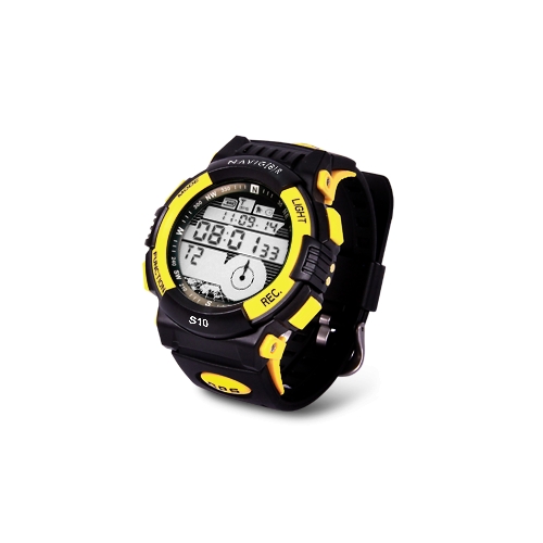
Track, monitor and store vital statistics from your adventures or exercise
Add a new dimension to your exercise and sporting experience. Ideal for walking, jogging, biking, hiking and skiing.
Monitor statistics such as coordinates, elevation, speed, trip logs and distance
Bonus PC software suite. Connect, download and share your trip data using Google Maps, Flickr and Picasa.