Showing posts with label device. Show all posts

Tripit - Travel Organizer

Frequent travelers know what a juggling act flight, hotel, rental and other bookings can be to track and organize. The Tripit app for iPad consolidates your travel plans, and automatically organizes them for you. Tripit combines your trip details to create a single, set-format itinerary on your iPhone or iPad that gets synced across your i-devices, as well as the Tripit.com website.


To build your Tripit itinerary, simply forward confirmation e-mails from flight, hotel, rental car, rail, event, and other types of travel confirmations to a Tripit e-mail address, and it will build your schedule and even keep friends, family, or co-workers informed, if you wish. Tripit also includes a built-in turn-by-turn-directions navigation app to help you reach your destinations, right from your itinerary.
A Tripit Pro version will update you on flight status, consolidate your frequent flyer information, and monitor your travel plans for any unexpected changes or delays.

Backpacker Map Maker

The Backpacker Map Maker fulfills the incredible potential of iPad to make detailed topographic map use and planning easy and effective. Backpacker Map Maker by Trimble Navigation (a long-established GPS and mapping firm) provides access to 68,000 downloadable topographic maps in the U.S. and Canada.


Once you have downloaded the maps for your destination, you may mark waypoints by touch drag-and-drop, use a virtual ruler to measure distances, overlay a digital compass, and display and copy exact coordinates. Once you have planned a trip, you may sync it to Backpacker Trip Cloud and access it from any Internet-connected device. You may also print maps, or export them in GPX mode. A dual-map mode lets you overlay maps (such as a Bing aerial view map over a topo).

Magellan RoadMate 1700 7" GPS Navigator

Magellan RoadMate 1700 7" GPS Navigator
The Magellan RoadMate 1700 device lets you bookmark your favorite destinations and searches with the OneTouch favorites menu so you can access them anywhere you travel. With a single touch, find your favorite café or restaurant when you're traveling within any city.
And talk about intuition! QuickSpell with SmartCity search helps you quickly enter addresses and narrow your address and city searches, making destination entry easy. Multi-destination routing with route optimization lets you plan your trip with multiple stops in the order you want or optimize a trip for the most efficient route, saving you time and money.
Safety first on the road
You can keep your eyes on the road as you drive because spoken street name guidance announces street names with every voice direction so you'll know when to make your next turn. Highway lane assist offers visual aids to point you in the right direction and ensure that you'll choose the correct lane well before your next turn.
Should your vehicle unfortunately break down as you travel, the AAA locate screen provides your location so help will know where to find you. Get support fast with the AAA Member Roadside Assistance phone number and your location displayed on the Magellan RoadMate 1700 device screen.
Traffic is always a headache, but your Magellan RoadMate 1700 device has the SmartDetour™ feature that prompts you to route around suddenly slow or stopped freeway traffic, automatically calculating the quickest detour.
The new Magellan RoadMate 1700 device is designed to help ensure driver safety, while providing useful features that make navigation truly enjoyable.
Ready to roll
Your Magellan RoadMate 1700 is ready to travel with preloaded maps and points of interest for the United States, Canada, and Puerto Rico. (Mexico map upgrade is sold separately).
With 6 million points of interest at your command you can easily locate gas stations, restaurants, ATMs, coffee shops, and much more. If you need more information or you want to save money, select the AAA search menu after your search entry. The integrated AAA TourBook provides ratings and descriptions on AAA approved places to stay, play, dine, and save.
When you're traveling down the Interstate and need to find gas, food, or lodging in a hurry, touch the highway exit POI icon to see which upcoming highway exits have the services you need.
Turn it on and go!™
The Magellan RoadMate 1700 device is loaded with premier features you'll need to get you where you want to go. (To view more helpful Magellan RoadMate 1700 features, click on the features tab).


Features

OneTouch favorites menu affords instant access to your personalized bookmarks of favorite places and searches anywhere you travel. With a single touch, find your favorite café or restaurant when you're traveling within any city.

7-inch wide color touch screen is easy to read with four-times the detail of a standard GPS and an anti-glare display that shows your position, POI, route, ETA, and more on the interactive map.

A/V input lets you watch video from your favorite media player

Preloaded maps give you information and directions as you travel the United States, Canada, and Puerto Rico. (Mexico map upgrade is sold separately).

AAA TourBook provides ratings and descriptions on AAA approved places to stay, play, dine, and save.

AAA Member Roadside Assistance gets you help fast with a toll-free member service number to assist you in finding an AAA approved tow truck or repair shop. The menu also shows your exact GPS location so you can provide precise information to your location.

6 million points of interest (POI) help you easily find gas stations, restaurants, ATMs, coffee shops, and much more.

Highway lane assist points you in the right direction and shows you the correct lane well before your next turn.

QuickSpell with SmartCity search narrows your address and city searches, making destination entry easy.

QWERTY keyboard lets you input text easily.

Multi-destination routing with route optimization lets you plan your trip with multiple stops in the order you want or optimize a trip for the most efficient route, saving you time and money.

Spoken street name guidance allows you to hear street names with every voice direction so you'll know when to make your next turn.

Highway exit POI shows you gas stations, restaurants, hotels, and more near upcoming highway exits.

Branded POI displays your favorite coffee shops, restaurants, and more by their respective logos.

SmartDetour™ functionality lets you navigate around accidents or stalled traffic, and chooses the best route to get you to your destination quickly and safely.

Customizable route method lets you select the shortest distance, fastest time, most use of freeways, or least use of freeways to customize your route.

Bird's eye 3D view lets you clearly see your surroundings in 2D or 3D to make navigation easier.

Auto re-route ensures that you will never miss a turn and quickly gets your back on track whenever you take a detour.

Auto Night View™ automatically adjusts your screen's color and contrast for easy night viewing.

Motorcycle GPS Navigator "Peaklife" - 3.5 Inch Screen, All Terrain Edition

3.5 Inch Motorcycle GPS Navigator provides high-speed and high-accuracy 42 channel GPS navigation, 400MHz processor with a windows operating system will handle whatever you throw it.

Meet this strong, durable portable GPS navigation for motorcycles that can be taken anywhere and handle anything. Designed by bikers for bikers, the all-terrain and all-weather “Peaklife” GPS navigation system has a sturdy Samsung S3C2416 computer processing unit. Connect to the battery to be the power source and bring this GPS to life. The FM Transmitter can get frequencies between 87.5 and 101.1MHz, therefore you can listen to the radio when being an easy rider. This “Peaklife” portable motorcycle GPS navigator comes with tools to fit safely and securely on your motorcycle, but that doesn't mean it can't handle a few accidental drops and bumps. This GPS navigator is even weatherproof, meaning it can handle rain, snow, sleet, and anything else Mother Nature can conjure up. The Windows operating system is a perfect platform for running the GPS, as it is well known, very compatible and renowned for its user friendly GUI.


Experience amazing real-time GPS guidance that will notify you of every street and intersection and lead you to your desired destination. The “Peaklife” Portable SatNav's high-tech 400MHz Samsung processor, 128MB of RAM, and powerful GPS chip will keep up with your speed to let you know exactly where you are. The GPS has Bluetooth as well and can run several media formats for your entertainment enjoyment. Use the GPS to watch AVI and ASF video formats or listen to Audio formats such as WMA and WAV files. Viewing pictures can be done via the GPS navigation system by observing any JPG, PNG or TIF image file. Ebooks can be read as you are parked up, by accessing any ebook that comes in TXT format. With an impressive 2GB memory that can be boosted by a micro SD card up to 8GB this GPS navigation system for your motorcycle has more than enough memory needed to provide you leisure and direction.

Popular motorcycle GPS devices all come with a high markup price due to their brand name, but we bring you the “Peaklife” Portable GPS Navigator for Motorcycles at an amazingly low, factory-direct price and with high quality hardware. This motorcycle GPS “Peaklife” navigator is the ideal passenger for them long journeys. In stock and at an incredible wholesale price. Brought to you by the leaders in GPS gadgets and wholesale electronics, Chinavasion.

  • 3.5 Inch Motorcycle GPS Navigator
  • Samsung 400MHz processor, 128MB RAM
  • Weatherproof
  • Battery Cable for connecting GPS to your bikes battery for constant power
  • RAM Mounting kit to fit nearly all bikes
  • 2GB Internal Memory and free 2GB micro SD card

TOMTOM® URBAN RIDER™3 GPS Device - 3.5" Glove Friendly Touch Screen

Product Features

Rider Pro

Smarter bike navigation at your fingertips

Simplified menu

The main menu has just two simple buttons 'Navigate to' and 'Browse map', so you can get going without any hassle.

3.5" glove-friendly touch screen

Improved glove-friendly screen for easier and safer navigation.


Advanced Lane Guidance

Clearly shows which lane to take at junctions so you don’t miss your turning. On the most difficult highway intersections, realistic 3D representation of the junction keeps you relaxed and safe.

IQ Routes™ technology

Only TomTom uses actual speed data collected from millions of users to calculate the fastest routes at any point in time. Imagine a route that takes into account rush hour, traffic lights, zebra crossings, school exits or even shopping crowds, every minute of every day. That's how smart IQ Routes is!

Simplified menu

The main menu has just two simple buttons 'Navigate to' and 'Browse map', so you can get going without any hassle.

Map Share™ Technology

Make corrections to your own map and benefit from thousands of corrections made by TomTom users every day– free of charge.

Waterproof

Your TomTom RIDER is designed to be as rugged and waterproof as you need it to be, so you can rely on it, whatever the weather.

Advanced Lane Guidance

Clearly shows which lane to take at junctions so you don’t miss your turning. On the most difficult highway intersections, realistic 3D representation of the junction keeps you relaxed and safe.

Latest map guarantee

Start driving with the latest map - guaranteed! If a new map for your device is available within 30 days of first use, you can download that map once for free via TomTom HOME, please note you are only entitled to one free map download. Due to the continuous improvements in our map quality, some new maps may not fit on your device. In these cases, detailed Map Zones are offered for download. You can only use one Map Zone on your device at a time but it's easy and free to change to another zone at any time using TomTom HOME. For more information check www.tomtom.com/mapzones.

TomTom Speed Cameras

Your device comes with fixed speed camera alerts pre-installed, to help you to drive more safely and responsibly, while saving money on speeding fines.

Enhance safety

3.5" glove-friendly touch screen

Improved glove-friendly screen for easier and safer navigation.
Speed-linked volume

Your device is designed to adjust its volume as you adjust your speed, so you can always get your instructions loud & clear.
TÜV tested

TomTom RIDER has passed TÜV safety, quality and durability tests to a level far beyond Euro normal CE standard.

Anti-glare screen and sun visor

Keep the sun off your screen for the optimum view, with the anti-glare screen and built-in sun visor.
Secure RAM mount

Your device is attached to the bike by a mount robust enough to handle tough biking conditions. This mount is made by world-leading mount supplier RAM.
Help Me! emergency menu

You can find help with local emergency service information at your fingertips. From hospitals to roadside assistance, this information will be useful in any area.

Product Specifications


GPS     GPS Receiver     Integrated GPS receiver with 20 Channel all-in-view tracking
Memory
CPU    380 MHz
Memory size    32MB RAM
Screen     Screen size     9cm (3.5 inch), 320 x 240 TFT colour LCD touchscreen
Battery
Battery Life    Internal rechargeable Li-Ion giving approx. 8 hours
Alternative power source    12V motorbike battery
Size & weight
Weight    310 grams
Size    113,2mm x 96,2mm x 52,9mm
Other     Operating Temp.     -10 to 55 degrees C
Other     Waterproof     (IPX7) - protects against any wet-weather conditions
Connectivity     USB     USB port and USB cable 2.0 for PC connection
Mounting     RAM mounting kit     fits nearly all bikes
Compatibility     Helmet compatibility     Supports leading Bluetooth®-enabled helmets

TOMTOM® XL™ CLASSIC SA GPS Device - 4.3" Wide Touch Screen

TOMTOM® XL™ CLASSIC SA GPS Device - 4.3" Wide Touch Screen
Large 11cm (4.3”) high quality touch screen.
Touch screen technology gives you the optimum view with the easiest control to make operating your device a pleasure.
6 Preloaded celebrity voices to brighten up your journey: DJ Fresh, Sasha Martinengo, Darren Scott, Mel Miller, Liezel and Beauty.


Helping you to keep your eyes on the road, spoken instructions include street names, to make turnings even clearer.
Make corrections to your own map and benefit from thousands of corrections made by TomTom users every day– free of charge.
Simplified menu for the easiest use.

Traveling GPS System for Walking & Driving in Europe

Most GPS devices are designed for either driving or walking purposes. However, certain models, such as the Garmin Nuvi 500 series, are capable of handling both types of navigation. In addition, some of these devices come with support for traveling in Europe. When using these GPS devices in Europe, you typically need to manually switch between walking and driving mode.


   Step 1 

Connect your GPS device to a power cable or make sure it has a working and fully charged battery.

Step 2

Press the power button to turn the GPS device on so it can begin searching for network signals. On most devices, the signal display uses the bar icons.

Step 3

Enter the address or coordinates of the location where you want to navigate using the GPS device's touchscreen or keyboard.

Step 4

Tap on the mode icon, usually located at the top of the screen, and then choose the type of navigation mode you want to use, such as driving or walking.

Polar's New RC3 GPS Watch

The Finland-based Polar Electro company has long been known for training electronics and quality heart rate monitors. But the company was slow to bring integrated GPS devices to market, instead relying on GPS accessory units that fed data to its watches. But Polar has taken another step toward an easier-to-use and set up, integrated GPS sport watch with its new RC3 model.


The RC3 has built-in GPS, a slim profile, and light weight (only 58 grams). The watch also has many training functions that have endeared Polar to athletes who are meticulous about their training, including individualized, pre-setup workouts, heart rate zone optimizer, fitness test, and training load metrics, in addition to all the basics. An accurate and durable (based on my experience) wireless heart rate monitor strap is available as an accessory, as are bicycle mounts, bike cadence sensors, and more.

Your GPS Will Disable Itself If It’s Going Too Fast

Whether it’s your windshield mounted Garmin or your pocket slung smartphone, your GPS device is programmed to disable itself under certain conditions.
If it’s travelling faster than 1200 MPH or above 65,000 feet in altitude, the GPS function will shutdown.
These restrictions were put in place to help ensure the technology could not be used for malicious intentions by foreign governments or terrorists.


Modern commercial airplanes do not typically approach this speed or altitude, so you can’t test this unless you build your own missile or weather balloon.
http://brokensecrets.com/

Magellan Switch Series

Switch is a crossover GPS watch designed primarily for running but expandable to cycling, swimming and other outdoor activities.
Switch tracks position precisely with GPS satellite data and records time, distance, speed/pace, elevation and more. High-sensitivity GPS allows Switch to acquire satellites quickly and track movement in many tough environments – near tall buildings, on mountainous terrain or under heavy tree cover. By using ANT+TM wireless technology, the Switch easily connects to a Magellan heart rate monitor or any ANT+ compatible heart rate monitor, foot pod, bike speed/cadence sensor and power meter.
Boasting a high-resolution display, Switch provides superior readability in varying light conditions - especially bright light. With 8 hours of battery life from a rechargeable lithium-ion battery, Switch has enough gas in the tank to capture most activities. And for endurance athletes, Magellan offers an optional Battery Extender Pack that provides 16 hours of additional battery life, for a total of 24 hours.
Switch is water-resistant to 50 meters, so it can be worn for an extended period in water to track swimming activities and other high intensity water and snow activities. The slim design and flexible wristband mean Switch can be used in a variety of conditions.


Switch breaks away from the pack by introducing a new training concept for GPS watches – Activity Pacer. Once a desired distance, time and speed/pace have been set, Activity Pacer not only shows the targeted progress, but more importantly, provides specific targets to attain or maintain the original goal.
Additionally, Switch includes fitness and training features such as customizable activity screens with over 80 data fields to choose from, 9 activity profiles to save device configurations based on activity type, auto lap, auto pause, backtrack navigation, marking locations, activity history, and more.

Allowed / Supported GPS Devices


Only Garmin GPS can be processed and the data is directly uploaded on the GPS, no files are provided to the riders. GPS with USB connector will work for sure. You can choose any GPS from the list below but we prefer those GPS which have USB connector.


Here’s the complete list:

Supported Garmin GPS devices
Colorado Series:
Colorado 300, Colorado 400c, Colorado 400i,
Colorado 400t
Dakota Series:
Dakota 10, Dakota 20
Edge Series:
Edge 605, Edge 705
eTrex Series:
eTrex 10, eTrex 20, eTrex 30
eTrex Legend C, eTrex Legend CX, eTrex Legend H, eTrex Legend HCX
eTrex Summit HC
eTrex Venture CX, eTrex Venture HC
eTrex Vista C, eTrex Vista CX, eTrex Vista H, eTrex Vista HCX
Foretrex Series:
Foretrex 101, Foretrex 201, Foretrex 301, Foretrex 401
Geko Series:
Geko 201, Geko 301
GPS Series:
GPS 60
GPSMap Series:
GPSMap 60, GPSMap 62, GPSMap 78, GPSMap 378, GPSMap 478, GPSMap 62 S, GPSMap 78 S, GPSMap 276 C, GPSMap 376 C, GPSMap 60 C, GPSMap 60 CSX, GPSMap 60 CX, GPSMap 62 SC, GPSMap 62 ST, GPSMap 62 STC, GPSMap 76 C, GPSMap 76 CS, GPSMap 76 CSX, GPSMap 76 CX, GPSMap 78 SC
Montana Series:
Montana 600, Montana 650, Montana 650 T
Nüvi Series:
Nüvi 500, Nüvi 550
Oregon Series:
Oregon 200, Oregon 300, Oregon 450, Oregon 550,
Oregon 400 C, Oregon 400 i, Oregon 450 T, Oregon 550 T
Rino Series:
Rino 520, Rino 530, Rino 610, Rino 650, Rino 520 HCX, Rino 530 HCX, Rino 655 T
Zumo Series:
Zumo 220, Zumo 550, Zumo 660, Zumo 665

Raymarine A57D GPS-Chartplotter/Fishfinder

The A57D GPS-Chartplotter/Fishfinder is a powerful yet compact navigation system combined with our award winning HD Digital fishfinder technology. The A57D features a vibrant direct sunlight viewable high resolution 5.7" VGA colour display. The rugged waterproof construction make the A57D a perfect fit for centre consoles and open cockpits.
While this A57D does not include any preloaded charts, enjoy the flexibility of adding optional Navionics Gold or HotMaps charts using the onboard CompactFlash card reader. Or step up to Navionics Platinum for the ultimate chartplotting experience. Navionics Platinum charts feature 3D and satellite cartography, panoramic port photos, dynamic tides & currents, enhanced coastal points of interest, and more!
Each A57D features a high sensitivity internal WAAS GPS receiver providing pinpoint chartplotter accuracy. For added flexibility add a RayStar 125 GPS antenna for situations where an external GPS antenna is needed.
Combine GPS and VHF technology for added situational awareness and safety. The A57D utilises DSC position polling (with DSC equipped VHF) and AIS target tracking (with optional AIS250) right on your chart
Harnessing the power of Raymarine's HD Digital fishfinder technology, the A57D's built-in digital sounder module offer unmatched fishfinder clarity and precision. Our patented HD Digital technology enables the A57D to instantly adapt to changing water and seabed conditions, delivering a dramatically clearer picture than ordinary analog fishfinders. Plus HD Digital technology enables true "hands-free" automatic operation, for an optimal fishfinder display at all times. Also enjoy full chartplotter integration, the A57D lets you mark fish targets or wrecks as waypoints. Easily switch screens back to the chartplotter and navigate right to your target!


Simply plug in to the included transom mount transducer and you have the ultimate digital fishfinder. Using the same patented HD Digital technology as its big-brother DSM300, the A57D's built-in sounder packs 500 watts RMS of power with a dual frequency (50/200 Khz) transceiver for excellent inshore and offshore performance. Directly compatible with the full array of A-Series transducers, and adaptable to the DSM300 family of transducers, a wide selection of styles are available to fit almost any boat including transom mounts, thru-hull mounts and in-hull solutions.
The A57D comes with our innovative tilt and swivel bracket featuring a quick release lever. Once the A57D is off the boat keep your cables tidy and protected with the built-in cable management system and protective cable caps. A flush mount kit is also available for other helm applications.
Add the optional SR50 weather receiver and the A57D becomes a powerful weather receiver utilising SIRIUS Satellite weather technology (US only). Graphical Nowrad radar, sea surface temperatures, storm tracks, city & buoy forecasts are now all at your fingertips. The A57D is also SIRIUS Satellite radio capable, simply connect the SR50 to your boat's existing stereo's auxiliary input. You have complete control of channels, volume, and can even set reminders for favourite songs and artists on over 100 SIRIUS radio channels (US only).
The A57D GPS-Chartplotter/Fishfinder comes packaged with a tilt & swivel bracket, suncover, power/NMEA cable, transom mount transducer, and instruction manual. The A57D is also SeaTalkNG capable allowing for engine monitoring with compatible engines. With SeaTalkNG you can even activate and control your Raymarine X Series SmartPilot directly from the A57D's chartplotter

F7932p GPS Dual SIM Card Router GPS Tracking, Vehicle Tracking

F7932 GPS+WCDMA/WCDMA ROUTER is a kind of cellular terminal device that provides data transfer function by public cellular network. Also, it supports double link backup and GPS function
It adopts high-powered industrial 32-bits CPU and embedded real time operating system. It supports RS232 (or RS485/RS422) and Ethernet port that can conveniently and transparently connect one device to a cellular network, allowing you to connect to your existing serial and Ethernet devices with only basic configuration.
It has been widely used on M2M fields, such as intelligent transportation, smart grid, industrial automation, telemetry, finance, POS, water supply, environment protection, post, weather, and so on.

Covert GPS Tracker PT8100

Real-Time Micro Portable GPS Tracking Device
The PT-8100N utilizes state of the art location technology whether you need to locate a child, person, or asset this GPS tracking device is one of the world's smallest and lightest GPS trackers. This GPS tracker can be located indoors and in other challenging places where conventional GPS devices fail.

Features & Benefits:
  • Locate On Demand
  • Real-Time Tracking
  • Scheduled Tracking - You configure time you want to track
  • Locate Indoors - Hybrid Assisted GPS
  • Battery Life 10 days
  • Very Small Footprint, Great For Covert Use


What You Need To Know About The PT-8100N:
  • Battery Life Is Dependent On How Many Locates You Do
  • The PT-8100N Is Equipped With A Panic Button
  • Monthly Service Is Based On Usage - View Plans
  • There Are Overage Charges For Going Over Your Allocated
    Number Of Locates
  • Zone Alerts Only Report When The Device Transmits Its
    Location Inside The Zone - It Will NOT Automatically
    Report A Zone Violation
PT-8100N CDMA Tracker:

CDMA trackers use AGPS technology, which allows the tracker to return a location in a challenging position, like inside a building.  Unlike GSM technology, the data transmission cost is much more expensive.  This is the reason service plans are tiered and overage charges apply if you go over your allocated plan limit.  When selecting a plan, please choose one that will be consistent with the number of locates you plan to do.  Going over your allocated number of locates will incur additional charges.
 Specifications:
  • Dimensions: 2.75" x 1.6" x 0.60"
  • Weight: 1.76 ounces
  • Operating Temperature: -4 to 140 degrees F
  • Location Technology: Qualcomm gpsOne
  • Position Accuracy:
    > Open Sky: 15 to 30 feet
    > Impaired: <60 feet 95% of the time
  • Extended Battery Options Available

How The PT-8100N GPS Tracker Works:
Once fully charged, the PT-8100N's internal battery is rated between 4  - 14 days, depending on usage. You can locate the PT-8100N on demand from our web portal 24/7. You can also set the PT-8100N to automatically report its position based on a time interval, which could range anywhere from every minute to every 24 hours. Every time a location "ping" is sent back to our servers, the data is recorded. You can later login to our web portal and see the locations on a Google Map (Map View, Satellite View, Hybrid View). Location data can also be printed out in a report format.
E-Mail & Cellphone Alerts:
The PT-8100N can be configured directly from our web portal to automatically send you an email and text message of every location generated by an "Interval Track". The email/text message will contain the address of the beacon at the time the location report was generated.
Zone Alerts:
The PT-8100N can also be configured from our web portal to send an alert if the device enters a zone that you set. In order for the PT-8100N to send an alert, the device must be actively reporting, i.e. set to interval tracking. As soon as the device sends a "Position Update" inside/outside the zone, it will trigger an alert.
What You Will Receive - Standard Configuration With Internal Battery
  • PT-8100N AGPS Tracking Device
  • 120 VAC Wall Charger
  • 1 Year Warranty
  • Free Technical Support
Please Note: Model 8100N is configured for use with an internal battery only.  
Countries Of Operation: United State & Canada Only

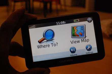
Garmin Nuvi 50 GPS receiver

The good: The Garmin Nuvi 50 features a large screen and an easy-to-use and easy-to-understand interface. Text-to-speech-spoken street names and colorful maps also aid user friendliness.
The bad: Text and graphics appear pixelated upon closer inspection. The dashboard mounting disc and USB sync cable are not included in the box.
The bottom line: Garmin's formula for entry-level GPS devices doesn't change much with the new Nuvi 50, but small tweaks, a lower price, and a massive screen enhance value.
Garmin's new 2012 line of GPS devices leads off with what the manufacturer calls its "Essential" series of entry-level navigation devices. By "Essential," Garmin means everything you need to get from point Alpha to Bravo. Things that you need include live GPS positioning with an extremely accurate sensor, turn-by-turn directions with spoken prompts and text-to-speech spoken street names. Things that you don't need (and don't get) include Bluetooth calling, traffic data, or Internet connectivity. If you're looking for a bare-bones navigation experience that still retains Garmin's level of simplicity, perhaps this series (which includes the 3.5-inch Nuvi 30 and the 4.3-inch Nuvi 40) is worth a look. We're taking a look today at the 5-inch Nuvi 50, the largest model in the series.
Design
The Nuvi 50 is built around a 5-inch WQVGA (480x272 pixels) color screen with resistive touch sensitivity.
There's only one physical control to be found on the Nuvi 50's chassis: a lone power button located along the top edge of the unit. Holding this button momentarily toggles the unit's power on and off. Tapping this button when the unit is in use calls up an onscreen menu with screen brightness controls and a virtual button that also depowers the unit.


On the backside, you'll find the USB port, microSD card slot, and loudspeaker.
Flipping the unit over reveals a small 1-inch loudspeaker on the back side. The rear panel is also where you'll find a microSD card slot for quickly adding extra map data and the Mini-USB port for charging and syncing with the downloadable desktop software, which we'll come back to shortly.
In the box, you'll find the 12-volt-to-USB charging cable that you'll use to keep your Nuvi juiced while driving. You'll also find the suction cup mount cradle in the box with the Nuvi 50; the design of which hasn't changed much over the years, either. It's still easy to place and remove the Nuvi from the cradle with one hand and the lever-actuated suction cup holds a clean glass surface quite securely and removes effortlessly when the need arises.


In the box, you'll find the Nuvi 50 itself, a suction cup mount, a car charger, and paperwork.
Interestingly, Garmin no longer includes the adhesive dashboard disc or a USB sync cable in the box with the new Nuvis. However, if your local laws forbid windshield mounting, Garmin will mail you the plastic puck at no charge if requested on the manufacturer's Web site.
Interface
Garmin's menu structure hasn't changed much in the last decade. Put the Nuvi 50 next to the Nuvi 200 I picked up back in 2007 and you'll notice that most of the buttons and icons are exactly where you expect them to be, for better or worse. As the saying goes, "If it isn't broken, don't fix it." Garmin's simplistic interface has long been one of its strongest assets, and it's definitely working for the 50.

 The Garmin Nuvi interface hasn't changed much over the years.

NATS and Airbox launch Aware GPS device to help pilots avoid controlled airspace

NATS and Airbox launch Aware GPS device to help pilots avoid controlled airspace.

This device, quite unlike anything else currently available, provides a low cost moving map display using a 4.3" backlit sunlight readable screen and contains the latest UK ICAO 1:500,000 chart.

In essence the devices primary function is to warn when the pilot is approaching, and then about to enter, restricted airspace.

Alerts include:
  • Controlled Airspace (Control Zones, Control Areas and Airways)
  • Aerodrome Traffic Zones
  • Danger Areas and Prohibited Areas
  • Restricted Airspace (Temporary) – e.g. air shows and Red Arrows displays
  • Transponder Mandatory Zones
  • MATZ
  • ATZ
  • GVS
  • PSL
  • HIRTA
The Aware device comes with the ICAO 1:500,000 scale UK chart preloaded on the supplied SD card, with more charts available on the manufacturer’s web site. For those pilots who prefer them, including myself, the 1:250,000 scale charts are available to download for a fee.


NATS airspace definition updates are free and digital chart updates are available at a very reasonable £24.99 per chart.

Inside the box
Once you open the small box you will find the unit itself. Well constructed with a metal chassis. the full list of contents includes:

Box Contents
  • Aware GPS Unit
  • 12/24v cigarette lighter power adapter
  • 240v power adapter
  • USB Cable for computer connection
  • Windscreen suction mount
  • Instruction pamphlet
  • Dimensions 12cm x 8cm x 1.5cm
  • Weight 170g
The unit itself is slightly wider than my iPhone, the same height, and slightly thicker.

Side by Side

Although the unit will run for about 1hr on its internal battery, it is recommended that external power is used. If cockpit power is not available as may well be the case if you are using school aircraft or indeed any that do not have provision for accessory power then the Aware device can be powered from an external battery pack via mini-USB. There are a great many solutions but Aware sell the PowerMonkey, a device we have reviewed (see here) which works very well.


The device
End ViewOnce the unit has been charged up, it takes around 20 seconds to display the ‘Disclaimer’ screen. After acknowledging that you are taken straight onto the main screen with the map display.

Indoors it the receiver was sensitive enough to receive a good GPS signal on occasion but obviously this device is supposed to be used outdoors and in clear view of the sky.

After several minutes outside, I received a good GPS fix and the device displayed my location on the map accompanied by a co-ordinates readout on the bottom left of the screen.

The aircraft icon on the screen turns bright green when a GPS fix has been established. In addition, the Altitude/Flight Level is displayed (more of this later on in the review).

There are + and icons at bottom left which control map zoom functions. The device comes with a small stylus, possibly a relic of the unit's PND origins. Using a stylus would soon become very fiddly when flying but I found that my fingers were perfectly sufficient!
Main Display Explained
Main Display

The other two icons in the bottom right corner are for centering the map with the current GPS position if you have moved the map away from the current location, and an ! button which leads to the "Emergency Information" screen which provides the following information:
  • Emergency transponder codes
    • 7500: Unlawful Interference
    • 7600: Radio Failure
    • 7700: General Failure
  • Emergency frequency: 121.5Mhz
  • Your current distance from neartest airfield, heading and current UTC time
Emergency Screen
Emergency Information Screen


On top is the On/Off button. On the left hand side of the unit you will find:
  • Mini-USB connector for power/data
  • 3.5mm headphone socket for connection to a headset or external speaker
  • AV in socket
  • SD card slot
  • Reset button
3D View


How does it work?
With the device switched on, GPS fix obtained device and chart loaded the Aware GPS calculates your location and displays it on the chart.

It then takes your heading and altitude/flight level and warns you if you are approaching any applicable controlled/ restricted/ dangerous airspace. I use the work ‘applicable’ because the device takes your altitude/ flight level into account and warns you about any possible airspace incursions that apply to you at that level only.

In Cockpit

For example, flying along at 5000 feet, you do not get warned of controlled airspace ahead of you that is only controlled up to 4000 feet as you are not going to enter that controlled area.

The screen shots demonstrates this quite clearly. The device has a 500 feet vertical warning buffer, meaning airspace 500 feet above or below you will also be warned against!

Screen Shot Screen Shot

In the screen shot above right, my height above ground level is 207 feet when this photo was taken. You can quite clearly see the Newcastle Control Zone highlighted in bright green. This is because this portion of the control zone is from SFC (surface) to FL 105 (10,500 feet). With myself being at 207 feet, if I were flying here, I could possibly penetrate this controlled area. If you look towards the coast, to the right of the two displayed high obstacles, you will see the extensions of the controlled airspace. These do not start at the surface, but at 1500 feet and 3000 feet respectively. Therefore, these zones are not highlighted as my current altitude/ flight level does not currently threaten that portion of the control zone.

What happens if I am heading towards controlled airspace at an altitude that would penetrate the controlled zone?
So, you are flying along in the cruise nicely and become slightly off course over time and drift towards an area that is controlled airspace. First thing that you would notice on approaching the controlled airspace is that the area concerned will now be highlighted in red, and emit an audible three loud, short ‘pips’. In the top right of the screen will be displayed information about the airspace that is being warned about. This includes information on:
  • Class of airspace
  • Name of airspace
  • Restriction levels
  • Distance to the airspace
As you enter the airspace, the device will emit two loud and longer ‘pips’ and the red information box from the top right of the screen will move down to the bottom of the screen.

What about obstacles?
The device will warn about tall obstacles in the same way as for controlled airspace.

The parameters for warnings are:
  • Airspace warning valid between sea level – 10,000 feet
  • Airspace warning range is 10 minutes
  • Vertical warning buffer is 500 feet
  • Obstacle warning radius is 0.5 Nautical Miles
Conclusion
The device performs well, with both audible and visible warnings of upcoming controlled airspace. A distance to the alerted zone is also given. Furthermore, a track line is also drawn which shows the current track you are on when heading into controlled airspace. This is a good feature as it shows the pilot where they are about to cross the controlled airspace, and therefore which direction to alter the course to in order to avoid ‘busting’ the airspace.

The unit is also capable of being used as a navigation device, just like a car GPS system. The Aware + includes navigation for £249.00 inc VAT or it can be purchased later as a navigation upgrade for £119 inc VAT. The navigation upgrade was not available for this review.

In conclusion, this is a great piece of equipment which would aid even the most experienced pilot flying VFR in the UK. The initial outlay for the device at £149.00 inc VAT makes it an absolute bargain and one that every pilot ought to consider.

As it also comes with free NATS airpsace definition updates and low cost chart updates it is remarkable value and so deservedly earns our PocketGPSWorld Highly Recommended award.
http://www.pocketgpsworld.com/

Motorola has announced a new Golf Edition of their MOTOACTV smart watch

Motorola has announced a new Golf Edition of their MOTOACTV smart watch. The device, as you’d imagine, includes new software-based tools which will enhance your 18 holes experience. GPS tracking allows you to record where you’ve taken your shots from in each round of golf, and will also tell you approximately how far you are from several areas on the green.


You can use the app or visit the site later on to check out how you did and compare your play to the pros. The device will cost $300. Those with the original edition aren’t SOL, however, as Motorola has committed to bringing an upgrade to bring these very same features.

Bluetooth spec gets GPS data sharing through GNSS

The Bluetooth Special Interest Group has cleared a proposal to more explicitly add location awareness to the standard. Bluetooth 2.0 and up devices will have the option of using the Global Navigation Satellite System (GNSS) profile, which will let a GPS-aware device share its location data with other Bluetooth hardware. Implementing GNSS could let a smartphone share its position with a dedicated camera, tablet, or other device without having special code.GPS sharing already exists, but usually requires either special apps on both sides of a connection or a dedicated receiver with software on one end.
Companies using Bluetooth can download the new profile now. Shipping products using the new GPS support may take some time, however, either through firmware updates or through new hardware.
http://www.electronista.com/

US Safety Administration cautions against use of moving maps

The US National Highway Transportation Safety Administration (NHTSA) has issued the first ever guidelines for in-car electronic devices, in a bid to reduce driver distraction.
The weighty tome, catchily titled "Visual-Manual NHTSA Driver Distraction Guidelines for In-Vehicle Electronic Devices" is aimed at car makers, and sets out the (for now voluntary) criteria for the use of electronic devices.
Amongst a long list of recommendations including positioning of displays, access to services such as telephony, internet, and text based information screens, Section V.5.b also have this to say on the subject of satnav, "dynamic, continuously moving maps are not recommended."


So the NHTSA want to turn back the clock and have us return to static turn graphics instead of having your live position indicated on a moving map. Their advice goes on to say that images should be static or updated no more than once every few seconds.
Sensible safety based idea or more evidence of nanny state? One thing is for sure, this may be voluntary now, but it would only take a few law suits in this famously litigious country to make this stuff mandatory.
http://www.pocketgpsworld.com/

How accurate is a GPS-based speedometer

Many GPS devices display your current speed, based on a simple calculation of how much distance you are covering in a given time period. However, drivers are often confused with these readings since it generally varies significantly from the vehicle’s speedometer.
So which speedometer is more accurate? Which one should be used to determine if you are driving within the posted speed limits? How does it relate to using speeding alerts in your telematics program?
Speeding is widely regarded as a significant contributor to fatal road accidents, and fleet owners find GPS-based speed calculations very useful in maintaining fleet safety. It’s important then that these speed calculations can be trusted to avoid drivers being falsely accused of speeding, as well as providing a reliable guide to determining a legally-safe driving speed.


How does a GPS device calculate speed?

Using GPS, a device is able to calculate a lot of information about a moving object. Using even basic time and location data, a GPS unit can quickly calculate the relative speed of the object, based on how much distance it covered in a given time.
GPS devices are positional speedometers, based on how far the device has moved since the last measurement. The algorithm also uses the doppler shift in the pseudo range signals from the satellites. It should also be noted that the speed reading is normalized, and is not an instant speed.
Speeds are updated at short intervals to maintain accuracy at all times. It uses frequent calculations to determine the vehicle’s speed. For example, using a standard movement per time calculation, if you have covered 80 feet in one second, the GPS device works out and converts that to MPH, which in this case is 55MPH.

Why does GPS speed differ from the vehicle’s own speedometer?

GPS speed calculations are more accurate than a vehicle’s speedometer since it is not affected by the same inaccuracies, including the vehicle’s wheel size or drive ratios. It is dependent however on GPS satellite signal quality but with the use of moving average calculations any errors are minimal.
Vehicle speedometers also require calibration to maintain perfect accuracy as general wear and tear, changing wheel sizes, and the manufacturers own ‘erring on the side of caution’ and setting the speedometer to read higher than the actual speed, all contribute to inaccuracies.
Generally most manufacturers claim a 0.1MPH tolerance with speed readings, however will go as far to say a 0.5MPH inaccuracy is possible, to make allowances for any satellite signal variations beyond their control.

Which speedometer should a driver use?

It really comes down to personal preference since both gauges are reliable for determining a safe, legal traveling speed. In most cases the vehicle’s speedometer will show a higher speed due to the aforementioned inaccuracies but this at least ensures the driver stays lower than the posted speed limit.
And while logged GPS data has been used to overturn speeding tickets, the cautious driver, who is keen to avoid infringements, fines, trouble from their employer or the possibility of an accident, will tend to err on the side of driving slower rather than pushing it too close to the limit.

Using GPS to record company speeding incidents

Any business that has company vehicles available for employee use is no doubt keen to avoid dangerous speeding, both from a public liability point of view, the possibility of accidents as well as infringement notices or demerit points. Using fleet management software such as Telogis Fleet, fleet owners are easily able to specify speeding notifications that can alert managers to speeding incidents in real time, or provide regular reports of this sort of activity.
Speeding alerts can be setup to record either speeds in excess of the posted speed limit, or simply if a certain speed is reached (ideal for vehicles that become unsafe above certain speeds e.g. forklifts).
How closely the speeding alerts are monitored can be set as well, such as how long the vehicle is speeding before the alert is triggered. This can be used to avoid false positive reports due to overtaking or temporary distraction.
Since employers know that speeds calculated by GPS devices are not only more accurate than a vehicle’s speedometer but also lower, it gives employees no excuse to be caught driving at unsafe speeds. Through a combination of regular reporting and driver coaching, fleet owners can make sure they are doing everything in their power to improve the safety of their staff and other road users.
http://gpssystems.net/